 rivers | guidebooks | forums | tips | other
Class: IV+; Ave. Gradient: 17 m/km; Portages: a few; Length: 21 km; Time: 8:00
Season: August to October; Rafts? no; Highlights: deep canyons; Crux move: an early start
Water Quality: good; Water Temperature: cool
PI: Chavarría (elev: 555 m); TO: Chicoasén
Description: (click here for general notes about my descriptions)
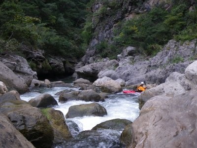
The Río Chavarría hides out in a very deep and narrow valley tucked away in the canyonlands north of Tuxtla Gutierrez. The trip provides stunning vistas and a very remote feel. It's fun as a 1-day or 2-day trip.
A full description is in the Mayan Whitewater: Chiapas & Belize guidebook.
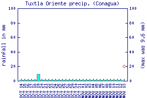
Flow Notes: There is no online gauge, which is unfortunate since in some years a decent flow is not easy to catch. (There is a gauge downstream of Chicoasén but the flow is dominated by the dam-release Río Grijalva. The Río Totopac gauge to the west can give you a better clue, plus the Tuxtla rain gauge, shown below, can give you an idea of recent rain patterns.) The only convenient place to scout the flow is near the TO--you can catch a glimpse at its confluence with the Bombaná, about 2.5 km out of Chicoasén on the Soyalo road. The Chavarría usually has less water than the Bombaná. Your best bet is in late September/early October, when there should always be enough water to make it down. My impressions are based on a run with barely 150 cfs at the confluence with the Bombaná (100 cfs at the PI).
 |
Accommodations: There are basic hotels in Chicoasén and Bochil. To get an earlier start, you might drive to Chavarría the day before and ask around for a nice family to "couch-surf" with.
Nearby Tourist Attractions: Not many in this area.