 rivers | guidebooks | forums | tips | other
Class: III; Ave. Gradient: 6 m/km; Portages: none; Length: 5.5 km; Time: 1 hour
Season: mid-June to December; rafts? no; Highlights: creeky bits; Crux Move: catching the water
Water Quality: decent; Water Temperature: cold
PI: Lamaltzac (elev.: 890m); TO: San Ignacio bridge
Description: (click here for general notes about my descriptions)
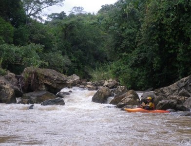
The Río Cantelá offers some low volume easy creeking and bushwacking, either as a quick run in itself, or as an appetizer to the buffet offered by the downstream run on the Corostic.
A full description is in the Mayan Whitewater: Chiapas & Belize guidebook.
Flow Notes: There is a streamflow gauge downstream on the Río Tulijá, linked to below. Only a fraction of the flow here is from the Cantelá, though, and is basically useless for guessing the flow at the PI. The creek needs heavier than average rains to come up. Below I also show historical flows at the Tulijá gauge.

click here for the height graph |
 |
Accommodations: there are a couple basic hotels in Bachajón.
Nearby Tourist Attractions: Agua Azul Falls and Palenque.