 rivers | guidebooks | forums | tips | other
Class: III; Ave. Gradient: 3 to 9 m/km; Portages: none; Length: 27 + 32 + 8.5 km; Time: 5 + 6 + 2 hours
Season: June to January; rafts? yes; Highlights: the big Almandro; Crux move: villagers in Middle 1
Water Quality: good; Water Temperature: medium
PI: Tzajalhucum footbridge (600 m) or Puente Santa Lucia (370 m) or Puente Portugal on the Almandro (265 m) or the Mazantic bridge (290 m); TO: Santa Catarina bridge
Description: (click here for general notes about my descriptions)
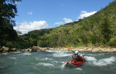
Starting at the end of the tough Travertine Canyon, the Middle1 features pleasant scenery, a bit of canyon, and a lot of fun class III rapids, some of which are III+ or possibly IV at certain flows.
The Middle2 section continues the mellow middle Almandro through somewhat populated areas with class II rapids. The main diff erence from the Middle1 run is that this section lacks the class IIIs, is much more easily accessed from the TO, and is a chunk of water that can be easily paddled in a day. The whole section contains some nice beaches to camp on, though in many places you’re close to a dirt road on RR (the main shuttle road from the TO).
The Middle3 section can provide some warm-up for the Lower Almandro, or a bit of fun in itself. Here the rapids are a step up from the Middle2. There’s some good play, especially after the confluence with the Río Mazantic, 2.5 km down
A full description is in the Mayan Whitewater: Chiapas & Belize guidebook.
Descent History: First descent by Rocky and Boris Trgovcich, December, 2011.
Flow Notes: The only online gauges are well downstream on the Río Almandro, and currently only show height. The Mazantic option has a shorter season, since its wide character makes it sensitive to low water
 |
 |
Nearby Tourist Attractions: not much in this area.