 rivers | guidebooks | forums | tips | other
Class: II; Ave. Gradient: 2 m/km; Portages: none; Length: 14 km; Time: 2:00
Season: June to February; rafts? yes; Highlights: open easier float; Crux move: none
Water Quality: fair; Water Temperature: warm
PI: Oxolotán bridge (52 m); TO: Tapijulapa
Description: (click here for general notes about my descriptions)
This section of Río Almandro (also called Río Tacotalpa in this area) has a number of class II rapids in pleasant scenery, an interesting side excursion to some travertine falls, a very easy shuttle, and friendly residents. The trip is best based out of the quaint town of Tapijulapa, denominated one of Mexico’s “Pueblos Mágicos” (“Magical Towns”) by the Secretary of Tourism. The town’s charm lies in the cobblestone streets, colonial buildings, hilly terrain with great vistas, friendly residents, various natural tourist attractions nearby, and pleasant climate.
A full description is in the Mayan Whitewater: Chiapas & Belize guidebook.
Descent History: This section has been paddled for decades by local residents, particularly those who run the Kolem Jaa ecotourist lodge. My run was January 22, 2012
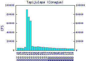
Flow Notes: The limestone geology of the drainage probably signifies consistent runnable flows June–January most years. There are online river gauges at both Oxolotán and Tapijulapa (fairly accurate in 2009).

click here for the height graph |

click here for the height graph |
Nearby Tourist Attractions: Cuevas Kolem Chen, various other caves, and the Kolem Jaa ecotourist resort.